
Sending a drone where a rope access technician used to go is not just faster. It changes the economics, the safety profile, and the quality of data you get back. But drone inspection is not a wholesale replacement for traditional methods, and knowing when to use which approach is where most operators are still finding their footing.

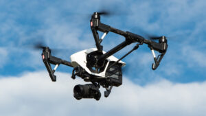
UAV / Drone Inspection: Remotely piloted aircraft equipped with visual, thermal, or ultrasonic sensors. Deployed without scaffolding or rope access. Suitable for external visual and thermal surveys of structures, vessels, and equipment.
Rope Access Inspection: Certified technicians working at height using rope systems to access structure surfaces directly. Enables tactile inspection and close-range NDT. High access flexibility, significant working-at-height risk.
Scaffolding Inspection: Temporary access platforms erected around a structure to allow inspection and maintenance. High setup cost and time. Preferred for large-area or sustained access requirements.
Conventional NDT: Non-destructive testing methods including UT thickness gauging, MPI, and radiography conducted by qualified technicians directly on the asset surface. Cannot be performed remotely by current drone technology in most applications.
Why the Comparison Matters Now
For most of the offshore and maritime industry’s history, inspecting a structure meant getting a person physically close to it. Rope access, scaffolding, and cherry pickers were the tools of the trade, each with well-understood cost structures, safety profiles, and output quality. The introduction of commercially viable inspection drones over the past decade has not so much replaced that model as it has forced a more deliberate conversation about when physical access is genuinely necessary and when it is simply the default because alternatives did not exist.
That conversation is now happening under real commercial pressure. Offshore operators facing ageing asset portfolios, compressed maintenance budgets, and tightening safety performance expectations are actively evaluating where drone inspection can reduce cost and risk without compromising the quality of information needed to make integrity management decisions. The results are instructive, and the picture is more nuanced than either the technology’s advocates or its sceptics tend to acknowledge.
In Malaysia, the context is sharpened by PETRONAS’s active push to improve asset integrity management across its operated and non-operated portfolio, by CAAM’s developing regulatory framework for commercial UAV operations, and by the growing number of operators in the Sabah and Sarawak offshore fields who are evaluating drone inspection programs as a direct response to the cost and logistical challenges of conventional access in remote locations.
The Cost Comparison
The cost advantage of drone inspection over scaffolding is clearest in situations where access setup time dominates the overall inspection budget. For a tall flare stack, a marine riser, or the external hull of an FPSO, erecting and dismantling scaffolding can consume a multiple of the actual inspection time. Mobilising a rope access team requires a minimum crew size, safety overhead, and a period of access rigging before any inspection work begins.
A drone inspection of the same structure can typically be completed by a two-person team, one pilot and one observer or data analyst, in a fraction of the time. The setup cost is the drone itself, the pilot’s day rate, and any regulatory approvals required for the operating environment. For a single inspection event, the cost differential can be significant. Across a portfolio of assets inspected on a recurring cycle, the cumulative saving is substantial.
For a tall flare stack or the external hull of an FPSO, erecting and dismantling scaffolding can consume a multiple of the actual inspection time. A drone covers the same structure in a fraction of the day.
The cost comparison narrows, and in some cases reverses, when the inspection scope requires close-range tactile assessment or non-destructive testing. A drone equipped with a visual camera can identify surface corrosion, coating breakdown, and structural deformation at distances that make quantitative measurement difficult. Confirming the depth of corrosion, measuring wall thickness, or conducting magnetic particle inspection requires a technician on the surface. In these cases, drone inspection is a triage and prioritisation tool rather than a replacement for physical access, and the cost model needs to reflect that.
The Safety Case
The safety argument for drone inspection is straightforward and compelling. Working at height is one of the leading causes of serious injury and fatality in the offshore and maritime construction and maintenance sectors. Every hour a rope access technician spends on a rope above a deck or over water is an hour during which a slip, equipment failure, or sudden weather change can have fatal consequences. Eliminating that exposure entirely is not a marginal safety improvement. It is a categorical reduction in risk.
This argument is strongest in situations where the inspection objective is primarily visual, where the structure geometry allows adequate drone access, and where the operating environment is within the drone’s performance envelope. In these conditions, replacing rope access with a drone is a straightforward risk reduction decision that most HSE functions will support without significant qualification.
Eliminating working-at-height exposure entirely is not a marginal safety improvement. It is a categorical reduction in risk. The safety case for drone inspection in the right application is straightforward.
The safety picture is more complicated in confined or obstructed environments, in high-wind conditions that reduce drone stability and control, and in situations where the drone itself poses a hazard to personnel or equipment below. A drone that loses control near pressurised pipework, rotating equipment, or a live flare tip creates a different category of risk than the one it was deployed to eliminate. Operating discipline, exclusion zones, and pilot competency are not optional extras in an inspection drone program. They are fundamental to the safety case holding up.
Data Quality: What Drones Deliver and What They Don’t
The data quality question is where the comparison between drone and traditional inspection becomes most technically demanding. Modern inspection drones equipped with high-resolution visual cameras, thermal imaging sensors, and in some specialised applications ultrasonic or LiDAR payloads can produce inspection datasets of considerable richness. A 4K visual survey of a jacket structure or vessel hull, flown at close range by a competent pilot, captures surface condition data at a level of detail that a visual inspection report from a rope access technician, relying on photographs taken under the constraints of working at height, may not match.
The critical point is that data quality from a drone inspection is not inherent in the technology. It is a function of the sensor payload, the flight planning, the pilot’s ability to position the drone correctly relative to the inspection target, and the analyst’s ability to interpret what the imagery shows. A drone flown too fast, at the wrong angle, or with inadequate lighting produces imagery that is less useful than a careful visual inspection by an experienced technician on a rope. The technology is the enabler. The competency of the operator determines the outcome.
The Regulatory Framework in Malaysia
Commercial drone operations in Malaysia are regulated by the Civil Aviation Authority of Malaysia. CAAM requires operators conducting commercial UAV activities, including inspection work, to hold a valid Unmanned Aircraft Operator Certificate and to ensure that pilots operating above certain weight thresholds hold the appropriate Remote Pilot Licence. Operations in controlled airspace, near aerodromes, or over populated areas require additional permissions.
For offshore and maritime inspection applications, the regulatory picture involves coordination with multiple authorities. Operations over offshore installations on the Malaysian continental shelf intersect with PETRONAS’s own requirements for drone operations on its facilities, which typically include a site-specific risk assessment, an operational flight plan, and in some cases a no-objection process with the installation operator before any drone is deployed.
Operator note: A drone pilot who holds a CAAM Remote Pilot Licence is qualified to operate commercially in Malaysian airspace. They are not automatically approved to fly over an offshore installation. Site approval, facility operator consent, and compliance with PETRONAS or client-specific UAV operating procedures are separate requirements that must be satisfied before any commercial inspection flight on or near an offshore asset.
The regulatory environment is still maturing. CAAM has been progressively developing its UAV regulatory framework, and operators planning to build drone inspection programs should expect the requirements to continue evolving. Engaging with a drone operator who actively monitors and complies with current CAAM requirements, rather than one operating on the assumption that offshore locations are unregulated, is a basic due diligence step.
Why Pilot Competency Is the Deciding Factor
The drone inspection market in Southeast Asia includes operators ranging from highly capable, well-equipped teams with genuine inspection expertise to individuals with consumer equipment and a commercial licence who have repositioned themselves as inspection service providers. The gap in output quality between these extremes is enormous, and it is not always visible in the way a service is marketed.
A competent inspection drone pilot is not simply someone who can fly a drone safely. They need to understand the inspection objectives well enough to plan flights that capture the data required, to recognise anomalies in the imagery that warrant closer attention, to manage the drone’s sensor systems to optimise data quality in the operating conditions encountered, and to produce a report that gives the integrity engineer the information they need to make a maintenance decision.
This is a skill set that overlaps with inspection engineering as much as it does with aviation. Operators who treat drone inspection as a photography service and integrity management as a separate discipline that happens after the data is collected are missing the integration that makes drone inspection genuinely valuable. The best outcomes come from programs where the pilot understands inspection, the engineer understands what the drone can and cannot see, and the two functions are closely coordinated from flight planning through to report delivery.
Choosing the Right Method for the Job
The practical framework for deciding between drone and traditional inspection methods starts with the inspection objective, not the technology. If the objective is a full external visual condition assessment of a structure that is difficult or costly to access, a drone is almost always the right starting point. If the objective includes quantitative thickness measurements, weld examination, or close-contact NDT, physical access will be required at some point, and the question becomes whether a drone survey can reduce the scope of that physical access by identifying the locations that genuinely need it.
The hybrid approach, using drone inspection for initial screening and triage, followed by targeted rope access or confined space entry for confirmatory testing at identified anomalies, is increasingly the model that mature inspection programs are adopting. It preserves the cost and safety advantages of drone inspection for the large fraction of an asset surface that is in acceptable condition, while directing physical access resources to the locations where they add the most value.
Can drone inspection replace a formal classification society survey?
Not directly, and not without classification society agreement. Most major classification societies have developed guidance on the use of remotely operated and autonomous inspection tools, and some have approved drone inspection as a method for close-up surveys under specific conditions. Operators seeking to use drone inspection to satisfy class survey requirements should engage their classification society early to agree the scope, methodology, and reporting format that will be accepted.
What drone payload is needed for a credible offshore inspection program?
At minimum, a high-resolution visual camera capable of capturing imagery at close standoff distances with sufficient detail for surface condition assessment. Thermal imaging capability is valuable for mechanical and electrical equipment inspection. For structural inspection programs where deformation monitoring is an objective, photogrammetry or LiDAR capability adds significant analytical value. The specific payload should be matched to the inspection objectives rather than selected on the basis of what the drone operator already owns.
How does wind affect offshore drone inspection operations?
Wind is the primary operational constraint for drone inspection in offshore environments. Most professional inspection drones have rated wind resistance limits, typically in the range of 10 to 15 metres per second, above which stable hovering and precise positioning become unreliable. In practice, the effective operating window is often more conservative than the rated limit, particularly when flying close to structures where turbulence and wind shadow effects create unpredictable airflow. Operators should specify the wind operating envelope in their operational risk assessment and have a clear go/no-go procedure based on site wind conditions.
What qualifications should an offshore inspection drone pilot hold?
At minimum, a current CAAM Remote Pilot Licence for commercial operations. For offshore work, additional qualifications that demonstrate understanding of offshore operating environments are valuable, including OPITO BOSIET for any operations requiring access to offshore installations, and documented experience in the specific inspection application. The pilot’s inspection knowledge, not just their aviation licence, should be evaluated before engaging a drone inspection service for integrity management work.
Sources: Civil Aviation Authority of Malaysia (CAAM) · PETRONAS UAV Operating Guidelines · DNV Recommended Practice DNV-RP-0171 (Use of Drones for Inspection) · Bureau Veritas Marine & Offshore Drone Survey Guidelines · Energy Institute Guidelines for the Use of UAVs in the Oil and Gas Industry
Continue reading
-
 drones What to Look for in a Professional Drone Training Programme for Maritime Operations
-
 drones Drone Training for Maritime & Oil and Gas Workers: The Business Case for Action
-
 drones Commercial Drone Operations in Malaysia: What CAAM Requires in 2026
-
 drones How Drones Are Transforming Offshore Inspections
-
 drones Fire on the Water: Iran Strikes the World’s Most Critical Oil Passage