
The Automatic Identification System transmits real-time vessel data across VHF frequencies to ships, coastal stations, and satellites, improving situational awareness in congested waterways and supporting search and rescue operations globally. This guide covers how AIS works, what Class A and Class B systems do differently, what data is broadcast, and where the technology’s limitations lie.
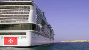
SOLAS mandate: IMO SOLAS Regulation V/19.2.4 requires AIS on all ships of 300 GT or above engaged in international voyages, and on all passenger ships regardless of size.
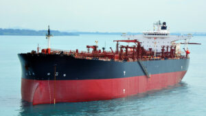
Two equipment classes: Class A, mandatory for passenger ships and cargo ships of 300 GT or above, with high transmission rate and full functionality. Class B, for smaller non-SOLAS vessels, with reduced transmission frequency and limited functions.
Operating frequencies: AIS 1 at 161.975 MHz (ship-to-ship) and AIS 2 at 162.025 MHz (ship-to-shore).
Technology: Self-Organising Time Division Multiple Access (STDMA), assigning 2,250 time slots per minute to prevent transmission interference.
Four data categories broadcast: Static (vessel identity and dimensions), dynamic (position, speed, course), voyage (draught, cargo, destination, ETA), and safety messages (free-text alerts).
Critical limitation: AIS is a navigational aid, not a replacement for radar, visual lookout, or human judgement. Over-reliance can create complacency that increases collision risk.
What AIS Is and Why It Matters
The Automatic Identification System is a shipborne tracking technology that enhances maritime safety by transmitting and receiving vessel information through VHF radio frequencies. AIS lets ships, coastal authorities, and Vessel Traffic Services identify, monitor, and track vessels in real time, significantly improving situational awareness in congested waterways, restricted visibility, and complex traffic environments. It supports collision risk assessment, assists search and rescue operations, and gives coastal monitoring agencies continuous visibility of vessel movements and hazardous cargo.
AIS is an important navigational tool, but it’s only an aid. It can’t replace radar, visual lookouts, or human judgement for collision avoidance. SOLAS and the IMO are explicit about this, and it remains operationally significant given the tendency for crew to over-rely on electronic systems at the expense of traditional watchkeeping discipline.
SOLAS Carriage Requirements
Under IMO SOLAS Regulation V/19.2.4, AIS is mandatory for all ships of 300 gross tonnes or above engaged in international voyages, and for all passenger ships regardless of size. The regulation reflects the IMO’s recognition that AIS provides material benefit to collision avoidance and traffic management, and that its value depends on consistent carriage and operation across the fleet.
AIS is a navigational aid. It can’t replace radar, visual lookouts, or human judgement for collision avoidance. Over-reliance on electronic tracking data at the expense of traditional watchkeeping remains one of the most commonly cited contributors to close-quarters situations at sea.
Class A and Class B: The Two AIS Types
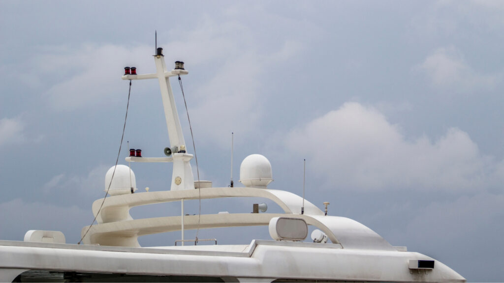
How AIS Works
AIS operates on two dedicated VHF frequencies: AIS 1 at 161.975 MHz for ship-to-ship communication, and AIS 2 at 162.025 MHz for ship-to-shore transmission. The system uses Self-Organising Time Division Multiple Access (STDMA), which assigns 2,250 time slots per minute across the two channels, allowing multiple vessels to transmit simultaneously without interference.
A standard AIS installation comprises one VHF transmitter, two VHF receivers, one DSC receiver, and a GPS unit. The system links to shipboard sensors and navigation displays, enabling automatic integration with ECDIS and radar overlays. Data transmitted by the vessel can be received by other ships within VHF range, by coastal monitoring stations, and, for vessels in open ocean areas, by satellite AIS receivers that provide global tracking coverage beyond the range of land-based infrastructure.
The Four Categories of AIS Data
Benefits and Limitations
AIS improves situational awareness for officers on watch, supports CPA and TCPA calculations for collision risk assessment, and gives coastal authorities continuous traffic information. It assists in monitoring vessel movements and cargo safety, and is a critical tool for search and rescue coordination, enabling rescue coordination centres to identify vessels in the vicinity of a distress incident within seconds.
The accuracy of AIS data depends entirely on what each vessel enters and transmits. Incorrect voyage data, manual input errors, or a Master’s decision to switch the system off for security reasons can all create gaps in the traffic picture that other vessels and coastal authorities are relying on to be complete.
The system’s limitations are equally important to understand. AIS accuracy depends on the transmitting vessel’s data being correct, and manually entered voyage information is only as reliable as the officer who entered it. Not all vessels carry AIS, and some Masters switch it off for security or operational reasons. Satellite AIS coverage introduces latency compared to real-time VHF reception. And the risk of complacency, treating AIS as a definitive picture of traffic rather than one layer of a multi-source watchkeeping system, remains an operational concern that training must address.
Frequently Asked Questions
How does AIS work?
AIS uses GPS and VHF radio signals to automatically transmit a vessel’s identification, position, speed, and voyage data to nearby ships and coastal authorities. STDMA technology organises transmissions into time slots to prevent interference between multiple vessels broadcasting simultaneously.
What are the two types of AIS?
Class A is mandatory for passenger ships and cargo vessels of 300 GT or above on international voyages, offering full functionality and high transmission rates. Class B is designed for smaller non-SOLAS vessels such as yachts and fishing boats, with reduced transmission frequency and limited functions.
Is AIS mandatory?
Yes, under IMO SOLAS Regulation V/19.2.4, AIS is mandatory for all ships of 300 GT or above engaged in international voyages and for all passenger ships regardless of size.
What data does AIS transmit?
AIS broadcasts four categories of data: static information (vessel identity and dimensions), dynamic data (position and movement), voyage information (cargo type, destination, and ETA), and safety messages (free-text navigational alerts).
Should AIS always be switched on?
Yes. AIS should remain operational at all times under normal circumstances. A Master may decide to switch it off for security or safety reasons in specific situations, but this is an exception to the general requirement for continuous operation and the decision should be documented accordingly.
Sources: IMO SOLAS Chapter V Regulation 19.2.4 (Carriage Requirements for Shipborne Navigational Systems) · ITU Radio Regulations — AIS VHF frequency assignments · IMO MSC Resolution 74(69) adopting the AIS performance standard · IEC 61993-2 (AIS Class A equipment standard)
Continue reading
-
 imo The IMO FSS Code: A Practical Compliance Guide for Shipowners
-
 regulation Lifeboat Systems: Types, Release Mechanisms & SOLAS Requirements Explained
-
 maritime technology What to Look for in a Professional Drone Training Programme for Maritime Operations
-
 regulation SOLAS Compliance for Life-Saving Appliances: What Ship Operators Get Wrong
-
 maritime technology Marine Fuel Trends 2026: LNG, Biofuels, Methanol, Ammonia & What to Expect